By Zoraida Díaz

Professor Muller-Karger’s connection to the ocean is seemingly predestined. For instance, he grew up in Venezuela, in a small town by the sea named “Arrecife,” which means “Reefs.”
“My father loved the ocean, loved to fish, swim, and snorkel,” says Muller-Karger, “and we were always on boats.” He then lists the fabled Jacques Cousteau documentaries, Sea Hunt, and 20,000 Leagues Under the Sea as inspirations: “You’ll hear this from all oceanographers my age,” he laughs, “those series and movies showed me fantastic things.”
He began chemical engineering studies at the Simon Bolívar University in Caracas and won a government fellowship to study abroad. It was at the Florida Institute of Technology in Melbourne that Muller-Karger found his calling: “I jumped from chemical engineering to oceanography.”
That switch set off a lifelong sequence of events that has benefited marine science for more than thirty years. In the 1980s, Muller-Karger began postgraduate studies at the University of Alaska’s Institute of Marine Science, focusing on whales. But when funding for that research ran out, he shifted to phytoplankton. He then spent five years observing phytoplankton blooms at the edge of the Arctic ice pack in the Bering and Chukchi Seas.
After the Arctic, he looked to the Amazon to continue his studies on phytoplankton. While researching the seasonal distribution of Amazon River phytoplankton productivity for his PhD at the University of Maryland, Muller-Karger sifted through thousands of grainy satellite images stored on reels of 10.5-inch magnetic tape at NASA’s Goddard Space Flight Center.
NASA noticed the young scientist’s grit and awarded him a Graduate Trainee fellowship.
Pouring over those images collected by the Coastal Zone Color Scanner, the first satellite image sensor designed to measure the subtle changes in the color of the ocean, Muller-Karger saw that the Orinoco and Amazon rivers, which together discharge some 240,000 cubic meters of water per second (㎥/s) into the Atlantic Ocean, create plumes of colored, low-salinity water that extend as far as 1200 kilometers (745 miles) north into the Caribbean Sea seasonally.
“People in the Virgin Islands and Puerto Rico knew that the ocean became turbid once a year, but didn’t know why,” he says, “It was the discharge from the Orinoco, hundreds of miles away!”
A few years after finishing his PhD, Muller-Karger went home on vacation. “The Cariaco Basin was right there in front of me,” he recalls, “within 60 miles off the Venezuelan coast.” The basin is the world’s largest wholly marine anoxic basin, reaching depths of about 1,400 meters. Its oxygen-free environment, stretching from roughly 140 meters below the surface to the bottom, prevents organisms from stirring the mud. Each year, particles sink to the bottom forming sediment layers, like the rings on a tree.
In 1995, the Cariaco Ocean Time-Series, led by Muller-Karger, began sampling the biology, geology, chemistry, and physics of the water column to understand layer formation in the basin depths and the surface conditions that influenced them. For more than two decades, researchers documented the processes occurring on the surface, where the ocean and atmosphere interact, gaining powerful insights into climate changes over the past several hundred thousand years.
For example, by comparing the chronology of ice layers with that of sediment layers in the Cariaco Basin, the long-term project enabled accurate dating of ancient carbon dioxide gas bubbles in ice cores from Greenland and Antarctica. It also showed how the weakening of the Trade Winds over a few years, combined with overfishing, led to the collapse of the Spanish sardine fishery in the southern Caribbean.
“The studies even shed light on the severe climate changes that led to the decline of the Maya culture,” said Muller-Karger. The sediments provided evidence that, beginning in the 7th century, decreased rainfall in the northern tropics—including the Maya lowlands—and a sustained drought lasting over 100 years likely devastated agriculture, impacting food supplies and decimating the Maya civilization.
The Cariaco Ocean Time Series program continued for 21 years until 2017, becoming one of the longest-running oceanographic studies in the world.
Early Coastal Zone Color Scanner scans had shown Muller-Karger that satellite remote sensing could help scientists identify and validate the biochemical processes being tested from boats.
Those scans also led Muller-Karger to many other breakthroughs, such as helping to decipher the origin and seasonal dynamics of the Great Atlantic Sargassum Belt, which has overwhelmed Caribbean and West African coasts for over a decade.
“It was amazing,” he says of that particular eureka moment when he found sargassum aggregations (large masses of brown seaweed) moving north, in unison with the bands of clouds around the equator known as the Intertropical Convergence Zone, a low-pressure region where northeast and southeast trade winds meet, featuring intense heating and heavy thunderstorms.
Muller-Karger can see the water from his second-floor office at the Knight Oceanographic Research Center at the University of South Florida. His office is bright, with NASA satellite images leaning against walls, delicate stained-glass sailboat mobiles bobbing above his desk, and colorful papier-mache horned devil masks hanging on the wall.
“Those come from different towns in Venezuela,” he says, looking at them fondly, “people wear the masks and dance in processions to protect the town from evil.”
The Dancing Devils of Corpus Christi, characterized by their iconic masks, are a 400-year-old tradition recognized as a UNESCO Intangible Cultural Heritage—a designation that honors the past while encouraging communities to preserve these vital traditions. This spirit of cultural preservation mirrors Professor Muller-Karger’s dedication to safeguarding marine life for future generations.
He was instrumental in creating the Marine Biodiversity Observation Network (MBON), a collaborative initiative that promotes best practices for collecting and disseminating marine biodiversity data. MBON engages scientists, marine managers, and the public in the protection and conservation of our oceans.
Muller-Karger has authored over 340 articles that have advanced understanding of continental margins in the global carbon budget, the links between rivers and oceans, and the acceleration of more advanced remote sensing for marine biodiversity, pollution, and climate change impacts.
His current work integrates satellite data, environmental DNA, and physical sensors to monitor how warming is influencing marine populations.
There’s an urgency to the science, as changes in marine ecosystems are coming faster and with greater intensity, while financial support for science and funding uncertainty are among the worst since World War II.
“We have good evidence that the water surrounding the Florida Keys is warming about one degree per decade.” Muller-Karger explains that scientific measurements collected over time help us understand small signals, such as temperature changes over a decade or more, as well as day-night and seasonal changes in temperature that can be 10 times larger.
“Finding these small signals and understanding what drives change is what makes science fascinating,” says Professor Muller-Karger as he stares out the window at the calm sea.
This work was supported by the U.S. Marine Biodiversity Observation Network (MBON) co-organized by NOAA, NASA, BOEM, and ONR through the National Oceanographic Partnership Program (NOPP).
Related news
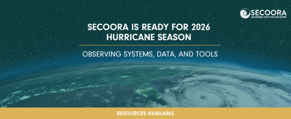
SECOORA Is Ready for the 2026 Hurricane Season
Hurricane season is here and SECOORA’s resources are available to help you stay informed. From real-time buoy data and live webcam feeds to ocean gliders and storm surge models, our network of observing systems is ready to support forecasters, emergency managers, researchers, and coastal communities throughout the Southeast.

Species Spotlight: Trichodesmium
Discover the remarkable role of Trichodesmium, a microscopic cyanobacterium that helps fuel life across the ocean. In this Species Spotlight, explore how researchers supported by the Marine Biodiversity Observation Network (MBON) are using imaging technology, genomics, and eDNA to better understand this “shape-shifting” organism and its influence on marine ecosystems, ocean health, and coastal economies.
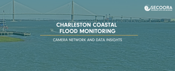
Charleston Coastal Flood Monitoring: Camera Network and Data Insights
A new story map explores how cameras in Charleston, South Carolina are helping communities monitor and respond to changing coastal conditions, from everyday weather impacts to flooding events. As a rapidly growing coastal city with a major working port, Charleston depends on an accurate understanding of water conditions to support transportation, public safety, infrastructure, and economic activity.