The NOAA U.S. Integrated Ocean Observing System (IOOS) Office, NASA, the Southeast Coastal Ocean Observing Regional Association (SECOORA), and partners at the University of Georgia’s Skidaway Institute of Oceanography worked together to install an oceanographic high-frequency radar (HFR) at the Kennedy Space Center in Cape Canaveral, Florida.
This location on the Space Coast, central to Florida’s east coast, fills an important gap in the IOOS HFR National Network, which supports offshore search and rescue efforts, ocean forecast modeling, and the tracking of oil spills, marine debris and harmful algal blooms. NASA and SECOORA partners are also interested in the use of the data to measure conditions impacting coastal erosion and to better understand offshore currents and sea state for spacecraft splashdowns.
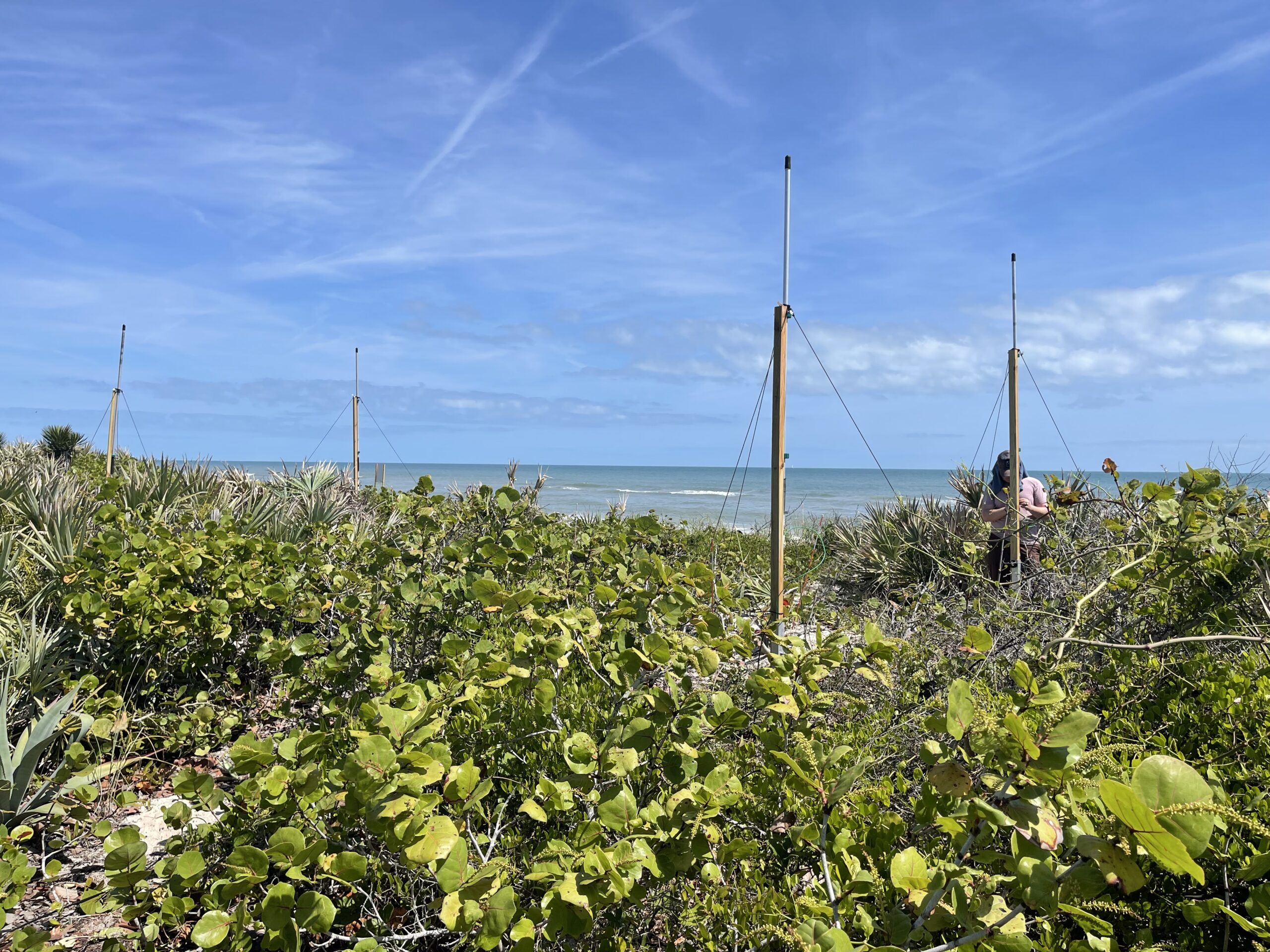
Kennedy Space Center is an ideal location for a HFR deployment, made possible by its undeveloped beachfront and proximity to the Gulf Stream—the strong, warm northward current that hugs the U.S. East Coast—which begins to shift slightly offshore along the Space Coast as the continental shelf widens.
HFRs are land-based systems that use radio waves to measure the speed and direction of ocean surface currents as well as wave height, period, and direction in near real-time. Kennedy Space Center was selected for the location of the new radar station to fill a large gap in surface current coverage. The Kennedy Space Center HFR works in tandem with another SECOORA HFR deployed at the Canaveral National Seashore. In the area where the radio waves from the two HFR stations overlap, the system can make maps of surface current speed and direction.
“This partnership between NOAA, NASA, and SECOORA is key to delivering the best marine environmental intelligence available for the State of Florida. The HF-radar sensor at the Kennedy Space Center provides oceanographic data necessary for making evidence-based decisions and forecasts that help preserve lives and property along this uniquely dynamic region of the Space Coast.”
— Brian Zelenke, NOAA U.S. IOOS Surface Currents Program Manager
Access the Data
The NOAA National Data Buoy Center HF-Radar National Server provides surface current information from radars across the country. To learn more about SECOORA HFRs and how the data are used, explore the High-Frequency Radar page.
Related news

Claire McGrath Joins SECOORA as Program and Development Manager
SECOORA welcomes Claire McGrath as Program and Development Manager, supporting the Southeast & Caribbean Coastal Disaster Resilience Partnership and membership growth.

Spotlight: Mobilizing to Save Florida’s Coral Reefs
Learn how scientists are racing to save Florida's Coral Reef through coral rescue, gene banking, reef restoration, and innovative conservation efforts after disease and marine heatwaves devastated one of America's most important marine ecosystems.

From a Whale’s Song to an Ocean’s Symphony: How AI Decodes Underwater Sound
Explore how SECOORA-funded research is using AI and machine learning to decode ocean soundscapes, detect boat noise, and support coral reef restoration efforts.