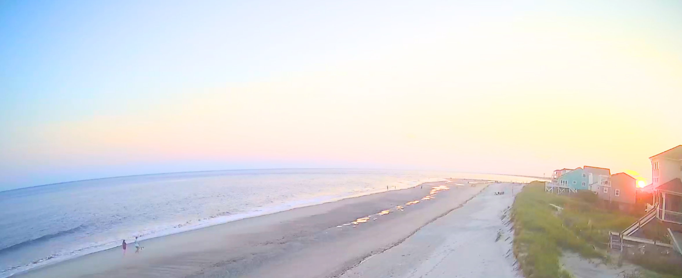
Empowering Communities: Real-Time Shoreline Monitoring in North Carolina
A new story map highlights how two cameras on Oak Island, North Carolina are being used to track changes along the coast from daily shifts in beach width to the impacts of major storms. These cameras provide continuous imagery that helps communities understand changing conditions and make informed management decisions.
A new story map highlights how two cameras on Oak Island, North Carolina are being used to track changes along the coast from daily shifts in beach width to the impacts of major storms.
These cameras capture continuous imagery throughout the day, providing a full view of coastal conditions, including shoreline movement, nourishment activity, and beach hazards.
Ongoing monitoring is critical so communities can make informed management choices.
From Images to Insights
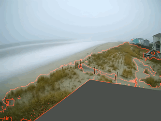
The team can detect where waves meet the shore and track how that position changes over time by using image-based algorithms.
By comparing the detected shoreline to a fixed baseline (such as the vegetation line) it becomes possible to identify patterns like narrowing beaches, dune erosion, and potential impacts to infrastructure or beach access.
Capturing Coastal Impacts During Storms
This approach becomes especially valuable during storm events.
During a December 2023 nor’easter, the Oak Island cameras captured significant dune erosion. The shoreline detection algorithm tracked these changes throughout the storm, showing how conditions evolved in near real time.
Why It Matters
This type of monitoring is helping communities, researchers, and decision-makers respond with better information by providing a clearer picture of how coastlines are changing.
Users of the data include coastal engineers at Moffatt & Nichol that use the imagery to observe shoreline conditions and assess preliminary storm impacts for their clients.
About WebCOOS
This effort is part of Webcam Coastal Observation System (WebCOOS). WebCOOS is a growing network of coastal cameras that provides real-time views of shoreline conditions. Using low-cost technology and image-based analysis, WebCOOS supports coastal monitoring, improves safety, and helps communities better understand and respond to changing conditions.
Interested in bringing WebCOOS to your community? Reach out to webcoos@secoora.org.
Related news

Claire McGrath Joins SECOORA as Program and Development Manager
SECOORA welcomes Claire McGrath as Program and Development Manager, supporting the Southeast & Caribbean Coastal Disaster Resilience Partnership and membership growth.

Spotlight: Mobilizing to Save Florida’s Coral Reefs
Learn how scientists are racing to save Florida's Coral Reef through coral rescue, gene banking, reef restoration, and innovative conservation efforts after disease and marine heatwaves devastated one of America's most important marine ecosystems.

From a Whale’s Song to an Ocean’s Symphony: How AI Decodes Underwater Sound
Explore how SECOORA-funded research is using AI and machine learning to decode ocean soundscapes, detect boat noise, and support coral reef restoration efforts.